Understanding Inca Trail elevation is essential when planning a trek to Machu Picchu. The route combines high mountain passes, steep stone stairways, cloud forest, and archaeological sites, but its difficulty comes from more than the highest point. Daily climbing, long descents, sleeping altitude, and your ability to acclimatize all influence how challenging the experience feels.
This guide explains the Inca Trail elevation profile for the classic four-day trek and the shorter route beginning at KM 104. You will find elevations in meters and feet, estimated elevation gain by day, a schematic elevation map, and practical advice for managing altitude. All climbing totals are planning estimates: campsites, itinerary variations, GPS devices, and elevation-data processing can produce different results.
Inca Trail Elevation at a Glance
How High Is the Inca Trail?
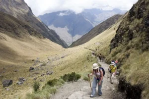
The highest point on the Classic Inca Trail is Dead Woman’s Pass, approximately 4,215 meters or 13,829 feet above sea level. However, hikers do not remain at this altitude for the entire trek. The route starts around 2,600 meters, crosses several mountain passes, and eventually descends to Machu Picchu, approximately 2,430 meters above sea level.
| Location or route feature | Approximate elevation | Elevation in feet |
|---|---|---|
| Classic Inca Trail start at KM 82 | 2,600 m | 8,530 ft |
| Wayllabamba | 3,000 m | 9,843 ft |
| Ayapata camping area | 3,300 m | 10,827 ft |
| Dead Woman’s Pass | 4,215 m | 13,829 ft |
| Pacaymayo camping area | 3,600 m | 11,811 ft |
| Runkurakay Pass | 3,950 m | 12,959 ft |
| Phuyupatamarca area | 3,600–3,670 m | 11,811–12,041 ft |
| Wiñay Wayna archaeological site | 2,650 m | 8,694 ft |
| Sun Gate, or Inti Punku | 2,720 m | 8,924 ft |
| Machu Picchu archaeological site | 2,430 m | 7,972 ft |
These figures describe commonly referenced locations rather than surveyed heights for every trail junction or tent platform. A campsite may sit above or below the landmark sharing its name. When comparing itineraries, use the operator’s actual overnight stops rather than assuming every four-day departure follows an identical daily elevation schedule.
Understanding Inca Trail Elevation Gain, Height, and Change
Elevation Height Versus Elevation Gain
Inca Trail elevation height means the altitude of a particular place above sea level. Elevation gain means the total vertical distance you climb while walking. These measurements answer different questions: altitude helps explain reduced oxygen availability, while cumulative ascent helps describe the muscular effort required to complete the route.
Why Cumulative Ascent Is Greater Than the Start-to-Summit Difference
Subtracting KM 82’s approximate elevation from Dead Woman’s Pass gives about 1,615 meters. That is not the trek’s total climbing. The trail repeatedly descends and climbs again, including additional passes after its highest point. Every uphill section contributes to cumulative ascent, even when you later lose the elevation you just gained.
What Does Inca Trail Elevation Change Mean?
Inca Trail elevation change can mean either the net difference between two locations or the repeated rises and falls along the route. For clarity, distinguish net change from cumulative gain. Machu Picchu is slightly lower than the classic trailhead, yet reaching it requires thousands of meters of uphill hiking across intervening mountains.
- Elevation: Your height above sea level at a particular point.
- Elevation gain: The accumulated uphill climbing over a section or entire trek.
- Elevation loss: The accumulated downhill movement.
- Net elevation change: Finishing elevation minus starting elevation.
- Maximum altitude: The highest point reached during the itinerary.
Why Published Elevation Totals Differ
GPS noise, recording intervals, mapping software, and smoothing settings can substantially affect cumulative totals. Operators also use different campsites and sometimes include or exclude archaeological-site detours. Treat a precise-looking number as route-specific rather than universal. A useful comparison requires matching the same itinerary, start point, finish point, and measurement method.
Inca Trail Elevation Map and Route Profile
A Simplified Classic Inca Trail Elevation Map
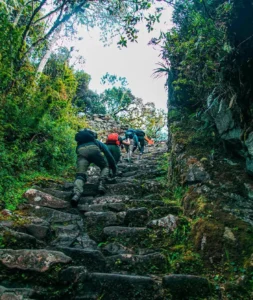
The following Inca Trail elevation map is a schematic sequence, not a navigational map or a distance-scaled graph. It shows how the route rises from the Urubamba Valley to its highest pass before continuing through additional mountain terrain and descending toward Machu Picchu. Actual overnight stops depend on campsite assignments.
KM 82: approximately 2,600 m
    ↑
Wayllabamba: approximately 3,000 m
    ↑
Ayapata area: approximately 3,300 m
    ↑
Dead Woman’s Pass: approximately 4,215 m
    ↓
Pacaymayo: approximately 3,600 m
    ↑
Runkurakay Pass: approximately 3,950 m
    ↓ then ↑ through rolling mountain terrain
Phuyupatamarca area: approximately 3,600–3,670 m
    ↓
Wiñay Wayna area: approximately 2,600–2,650 m
    ↑
Sun Gate: approximately 2,720 m
    ↓
Machu Picchu: approximately 2,430 m
How to Read the Inca Trail Elevation Profile
The Inca Trail elevation profile reveals two important challenges: the sustained ascent to Dead Woman’s Pass and the later concentration of steep downhill steps. The highest pass is usually the greatest altitude test, but the descent toward Wiñay Wayna can be equally demanding on tired legs. Vertical difficulty is not limited to uphill travel.
Use Elevation Together With Distance
A climb of 700 meters spread across a long, gently graded trail feels different from the same gain on steep stairs. When assessing your itinerary, review elevation gain, walking distance, terrain, and expected hiking time together. Ask your operator for a route profile showing campsite locations, not simply a list of landmark heights.
Classic Inca Trail Elevation Gain: Four-Day Route Overview
How Much Climbing Does the Classic Trek Include?
Classic Inca Trail elevation gain commonly falls within a broad planning range of approximately 2,500–3,500 meters, or 8,200–11,500 feet, across the trek. This is not an official fixed total. Recorded ascent varies with the exact route and data source, so confirm the expected climbing for your booked departure rather than treating one published figure as definitive.
The classic route is generally described as approximately 42–45 kilometers long, although reported distances also vary. Its challenge comes from combining this distance with altitude, uneven paving, sustained stair climbing, and consecutive hiking days. A lower daily distance does not necessarily mean an easier day when the route climbs steeply above 4,000 meters.
4 Day Inca Trail Elevation Gain by Day
The table below illustrates Inca Trail elevation gain by day for a traditional itinerary sleeping around Wayllabamba, Pacaymayo, and Wiñay Wayna. Many operators instead use Ayapata and Chaquicocha, shifting substantial climbing between days. The ranges are approximate cumulative ascent estimates, not differences between morning and evening elevations.
| Day | Illustrative section | Estimated uphill gain | Main elevation feature |
|---|---|---|---|
| Day 1 | KM 82 to Wayllabamba | 500–750 m / 1,640–2,460 ft | Gradual ascent with rolling terrain |
| Day 2 | Wayllabamba to Pacaymayo | 1,200–1,400 m / 3,940–4,590 ft | Crossing Dead Woman’s Pass |
| Day 3 | Pacaymayo to Wiñay Wayna area | 650–1,000 m / 2,130–3,280 ft | Additional passes before a long descent |
| Day 4 | Wiñay Wayna area to Machu Picchu | 150–300 m / 490–980 ft | Climb toward the Sun Gate |
Day 1: Valley Walking and the First Sustained Ascent
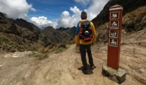
The first day introduces the trail’s changing gradients, with valley views, archaeological stops, and an ascent toward the first campsite. On a Wayllabamba itinerary, sleeping elevation is approximately 3,000 meters. Although this is below the route’s highest terrain, travelers arriving directly from low altitude may already notice heavier breathing and a slower comfortable pace.
How an Ayapata Campsite Changes Day 1
If your group continues to Ayapata, the first day becomes longer and climbs higher, reaching roughly 3,300 meters. That shifts some effort away from the following morning, but it also creates a higher first sleeping altitude. This is why an accurate comparison of Inca Trail elevation per day must include campsite names.
Day 2: The Highest Point on the Inca Trail
On the traditional schedule, day two contains the largest sustained climb. Starting near Wayllabamba, hikers ascend toward Dead Woman’s Pass before descending to Pacaymayo. The approximately 1,215-meter difference between Wayllabamba and the pass explains most of the day’s climbing, while small undulations can increase the cumulative ascent recorded by a GPS device.
Some Itineraries Cross Two Passes on Day 2
Departures sleeping at Ayapata may continue beyond Pacaymayo and cross Runkurakay Pass before reaching Chaquicocha. This produces a considerably different workload from the table’s example. When reviewing 4 day Inca Trail elevation gain, check whether the itinerary’s hardest day includes one major pass or two, along with the total walking time.
Day 3: Additional Climbing and a Major Descent
From Pacaymayo, the route climbs toward Runkurakay Pass and continues through varied mountain and cloud-forest scenery. Later, the trail descends steeply toward the Wiñay Wayna area. Finishing lower than you started does not make this a climbing-free day: repeated uphill sections still contribute substantially to the day’s cumulative elevation gain.
Why Downhill Hiking Can Feel Harder Than Expected
Long stone staircases place repeated braking loads on the quadriceps and knees. Wet surfaces, irregular step heights, and fatigue can make these descents slow. Short, controlled steps and suitable footwear help maintain stability. Trekking poles may help where permitted, but confirm current route and archaeological-site restrictions, including requirements for protective rubber tips.
Day 4: The Sun Gate and Arrival at Machu Picchu
The final approach contains smaller climbs, including steep steps before the Sun Gate, followed by a descent toward Machu Picchu. Altitude is lower than on the central mountain passes, but accumulated fatigue still matters. The hiking route, arrival arrangements, and subsequent archaeological-site visit depend on your permit and the current visitor-management rules.
Dead Woman’s Pass Inca Trail Elevation
What Is the Elevation of Dead Woman’s Pass?
Dead Woman’s Pass Inca Trail elevation is approximately 4,215 meters, or 13,829 feet. Its Quechua name is commonly written as Warmiwañusca. This is the highest point of the classic trekking route and the location most closely associated with its altitude challenge, although hikers can develop altitude-related symptoms before reaching the pass.
Why the Pass Feels So Demanding
The approach combines sustained climbing, stone steps, exposure to changing weather, and reduced oxygen availability. Your usual low-altitude walking speed may be unrealistic here. Most hikers benefit from maintaining a slow, steady rhythm rather than repeatedly walking too fast and stopping. Reaching the top is followed by a descent, not the end of the day.
Altitude Is Different From Technical Difficulty
Under normal conditions, this section is a hiking route rather than a technical mountaineering climb. However, the absence of ropes or climbing equipment does not make it easy. Fitness supports endurance, while acclimatization helps your body adjust to altitude; neither eliminates the need to monitor symptoms and follow your guide’s instructions.
Short Inca Trail Elevation: KM 104 to Machu Picchu
KM 104 Inca Trail Elevation
KM 104 Inca Trail elevation is generally described as approximately 2,100–2,200 meters, or 6,890–7,220 feet, depending on the exact reference point near the railway stop and trail entrance. The route climbs toward Wiñay Wayna before joining the final section of the classic trail and continuing through the Sun Gate.
Short Inca Trail Elevation Profile
The Short Inca Trail elevation profile is much lower than the classic route’s profile. Its highest commonly referenced point is the Sun Gate, around 2,720 meters. However, lower altitude does not mean flat walking. The initial ascent includes substantial stair climbing, and warm, humid conditions can make the effort feel more demanding.
- Starting area: Approximately 2,100–2,200 meters.
- Wiñay Wayna: Approximately 2,650 meters.
- Sun Gate: Approximately 2,720 meters.
- Machu Picchu: Approximately 2,430 meters.
- Typical walking distance: Roughly 10–12 kilometers, depending on included sections.
Short Inca Trail Elevation Gain
Short Inca Trail elevation gain is reasonably planned as approximately 700–1,000 meters, or 2,300–3,280 feet, of cumulative ascent. This range allows for the main climb and smaller undulations. The difference between the starting altitude and the Sun Gate alone is smaller, but that simple subtraction does not capture every uphill section.
Who Should Consider the Short Route?
The short route suits travelers wanting Inca stonework, Wiñay Wayna, and the Sun Gate approach without crossing a 4,215-meter pass or camping for several nights. It remains a sustained hike rather than a gentle sightseeing walk. Assess your stair-climbing endurance, tolerance for heat, and ability to walk for several hours before booking.
1 Day and 2 Day Inca Trail Elevation Gain
2 Day Inca Trail Elevation Gain
For many packages, 2 day Inca Trail elevation gain refers primarily to the KM 104 hike completed on the first day. Travelers commonly spend the night in Aguas Calientes and visit Machu Picchu the following day. Consequently, the main trail ascent is broadly similar to the short-route estimate: approximately 700–1,000 meters.
Second-Day Transport and Optional Walks
Aguas Calientes sits below Machu Picchu, so walking uphill to the entrance adds several hundred meters of ascent compared with taking the bus. Additional mountain hikes also change the total and require appropriate reservations. Check whether a quoted package elevation figure includes only the Inca Trail or every optional walk across both days.
1 Day Inca Trail Elevation Gain
1 day Inca Trail elevation gain is often similar to the two-day version when both begin at KM 104 and follow the same trail. The difference is usually the travel and sightseeing schedule, not a shorter ascent. A one-day package can feel more rushed because transfers, hiking, and return arrangements are compressed into one long day.
Comparing the Short and Classic Routes
Choose between routes based on maximum altitude, cumulative ascent, and consecutive walking days rather than the package name alone. The classic trek offers a longer mountain journey but requires greater endurance and more altitude preparation. The short trek avoids the highest passes while retaining a meaningful uphill challenge and the historic approach to Machu Picchu.
| Feature | Classic route | Short route |
|---|---|---|
| Usual starting point | KM 82 | KM 104 |
| Highest point | Approximately 4,215 m | Approximately 2,720 m |
| Estimated cumulative ascent | Approximately 2,500–3,500 m | Approximately 700–1,000 m |
| Typical hiking schedule | Four days | One main hiking day |
| Primary challenge | High passes and repeated exertion | Sustained stairs and possible heat |
Machu Picchu Inca Trail Elevation and Final Approach
Is Machu Picchu the Highest Point?
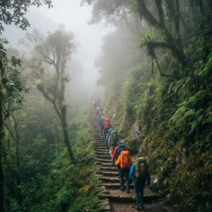
No. Machu Picchu Inca Trail elevation is often misunderstood because the destination is famous for its mountain setting. The archaeological site sits around 2,430 meters, substantially below Dead Woman’s Pass and also below Cusco, approximately 3,400 meters. On the classic trek, the most significant altitude exposure occurs before you arrive at the ruins.
Machu Picchu Inca Trail Elevation Gain Explained
The phrase Machu Picchu Inca Trail elevation gain can refer to the complete classic trek, the shorter KM 104 route, or the final approach from Wiñay Wayna. These are different measurements. Specify your starting point before comparing numbers, and do not add optional summit climbs unless they are actually included in your itinerary.
Huayna Picchu and Machu Picchu Mountain Are Separate Hikes
Huayna Picchu and Machu Picchu Mountain involve additional climbing beyond the standard Inca Trail journey. Access depends on separate ticket availability, permitted circuits, and scheduling rules. If you plan either hike after trekking, account for accumulated fatigue and confirm that your admission arrangements allow the combination rather than assuming it is automatically included.
Inca Trail Elevation Difficulty and Altitude Preparation
How Difficult Is the Inca Trail Because of Elevation?
Inca Trail elevation difficulty results from altitude interacting with physical effort. Stairs that feel manageable near sea level can become slow, breathless work above 3,500 meters. Long descents and uneven paving add separate challenges. Hiking experience and cardiovascular fitness help, but even strong athletes can develop altitude sickness if their ascent is too rapid.
Acclimatization Before the Trek
Allow several days in the region before starting the classic route when possible, particularly after arriving from low elevation. Many travelers schedule at least two or three nights, although individual needs differ and no schedule guarantees protection. A staged stay at lower Sacred Valley elevations may suit some travelers better than immediately sleeping higher in Cusco.
Recognizing Symptoms That Need Attention
Headache with nausea, dizziness, unusual fatigue, or poor appetite after ascending can indicate acute mountain sickness. Tell your guide promptly and do not ascend further with symptoms. Worsening symptoms require descent and medical assessment; confusion, difficulty walking straight, or breathlessness at rest are emergency warning signs requiring urgent help and descent when safely possible.
Training for Daily Elevation Gain
Prepare with progressive uphill walks, stair sessions, and longer hikes carrying your expected daypack. Include controlled downhill practice because descending requires strength and balance that flat walking does not fully develop. Build gradually, and practice on consecutive days when feasible to understand how your legs respond to repeated effort rather than one isolated workout.
- Build endurance: Increase comfortable walking duration progressively.
- Train climbs: Use hills or stairs to practice sustained ascent.
- Strengthen legs: Add appropriate step-ups, squats, and calf exercises.
- Practice descents: Develop control without rushing or overloading your knees.
- Test equipment: Wear your intended footwear and carry a realistic pack.
Pacing, Hydration, and Medical Planning
Start conservatively, eat regularly, and drink according to thirst and conditions rather than forcing excessive water. Avoid assuming that hydration, coca products, or fitness prevents altitude illness. Travelers with relevant medical conditions or concerns about preventive medication should consult a qualified clinician before departure and discuss the actual sleeping elevations and highest pass on their itinerary.
Final Planning Checklist for Inca Trail Elevation
Before booking, request your operator’s exact Inca Trail elevation by day, campsite list, daily walking distances, and approximate cumulative ascent. Confirm whether the itinerary crosses one or two passes on its hardest day and whether optional walks are included in the figures. These details are more useful than a single maximum-altitude number.
The essential distinction is straightforward: the classic route reaches approximately 4,215 meters and involves several days of substantial climbing, while the KM 104 route reaches approximately 2,720 meters with one principal hiking day. Choose the experience that matches your preparation, allow time to acclimatize, and treat every elevation estimate as part of a broader assessment of terrain, weather, and personal readiness.